Jennifer Henning's German Genealogy Site

Let me know if we are researching the same people or places.

Name and place indexes for this entire web site.

Information on just this family and region.

Introduction to this web site.
Copyright ©2005-2018 by Jennifer Henning
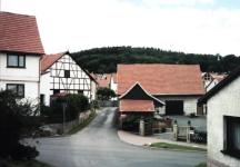
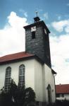
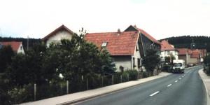
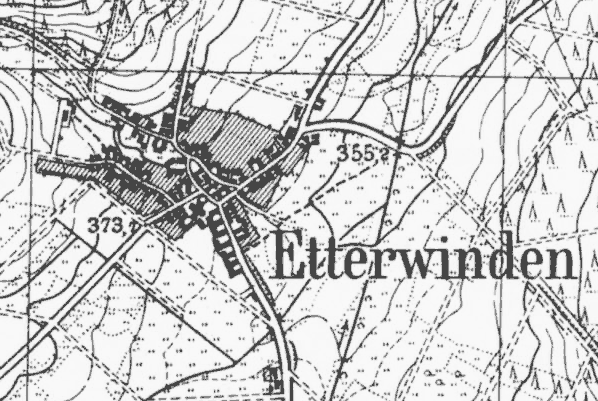
Etterwinden
Kreis Eisenach, Thüringen
(Click on picture for larger image)
Related Families in Etterwinden
Navigation
Let me know if we are researching the same people or places.
Name and place indexes for this entire web site.
Information on just this family and region.
Introduction to this web site.
This page created August 19th, 2005, updated September 30th, 2016, last edited September 24th, 2018
Kreis Eisenach, Thüringen
(Click on picture for larger image)
| |
| To zoom out to a larger area map click here. | |
|---|---|
Map dates from 1907, updated 1927. It covers an area of approximately 1.3 by 0.8 km (0.8 by 0.5 US miles).
Map image was adapted from 1:25K Prussian Landsaufnahme, page 5127 (Bad Salzungen)
The following table shows which of the individuals included in this web site are connected to Etterwinden and over what time span they are found here.


