Jennifer Henning's German Genealogy Site

Let me know if we are researching the same people or places.

Name and place indexes for this entire web site.
Information on just this family and region.

Introduction to this web site.
Copyright ©2005-2016 by Jennifer Henning
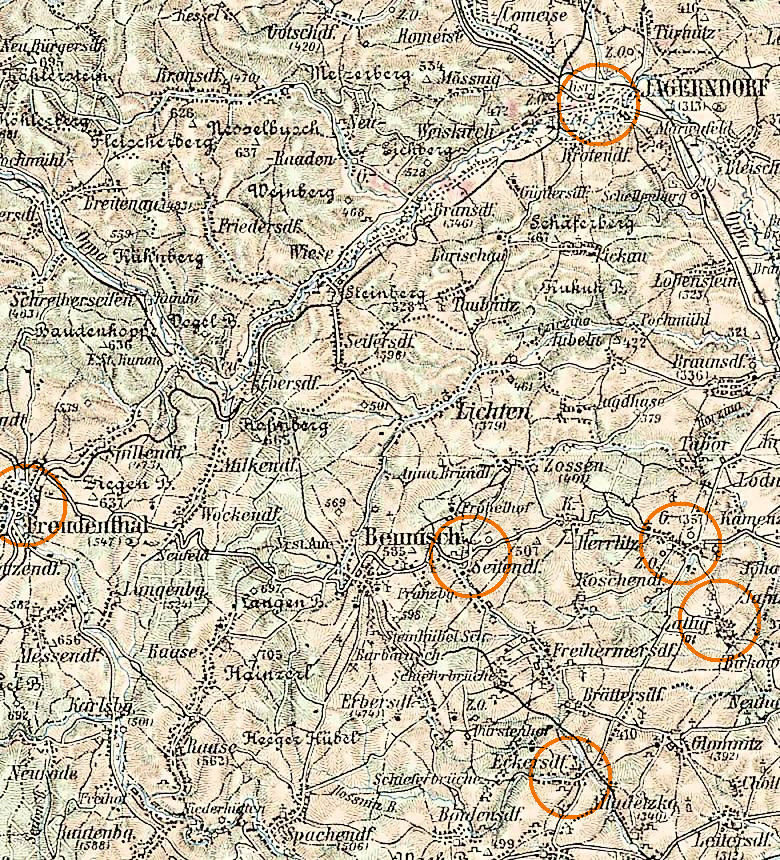
Jägerndorf area
Navigation
Let me know if we are researching the same people or places.
Name and place indexes for this entire web site.
Information on just this family and region.
Introduction to this web site.
This page created December 24th, 2007, last updated November 25th, 2016
| ||||
| To zoom out to a larger area map click here. | To zoom in to a more detailed map, click within any Gold Circle on the above map. | |||
|---|---|---|---|---|
Map dates from 1878, 1914. It covers an area of approximately 23 by 25 km (14 by 15 US miles).
Map image was adapted from 3rd Military Mapping Survey of Austria-Hungary, 1:200K, sheet 19