Mitch Blank's North-German Genealogy Site

Let me know if we are researching the same people or places.


Name and place indexes for this entire web site.

Information on just Kreis Greifenberg, Pommern.

Introduction to this web site.
Copyright ©1998-2021 by Mitch Blank
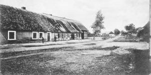
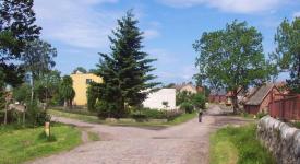
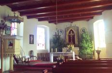
Triebs
(Sometimes called Tribus, now Trzebusz)
Kreis Greifenberg, Pommern
(Click on picture for larger image)
Related Families in Triebs
Navigation
Let me know if we are researching the same people or places.
Name and place indexes for this entire web site.
Information on just Kreis Greifenberg, Pommern.
Introduction to this web site.
This page created December 15th, 1999, updated June 14th, 2019, last edited December 15th, 2021
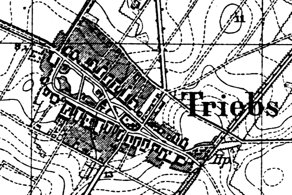
Kreis Greifenberg, Pommern
(Click on picture for larger image)
| |
| To zoom out to a larger area map click here. | |
|---|---|
Map dates from 1890, updated 1929. It covers an area of approximately 1.3 by 0.9 km (0.8 by 0.5 US miles).
Map image was adapted from 1:25K Prussian Landsaufnahme, page 1957
The following table shows which of the individuals included in this web site are connected to Triebs and over what time span they are found here.
| Surname | Given names and the range of dates the person was found in Triebs |
|---|---|
| Baatz |
 Jacob 1822 Jacob 1822 |
| Brandt |
Anna 1856 |
| Büge |
Johann Gottfried 1863Marie Rosalie 1863..1864 |
| Glander |
Emilie Minna 1878..1910 |
| Hoge |
 Bertha Mathilde 1864 Bertha Mathilde 1864 Ferdinand 1864 Ferdinand 1864 Martin 1825 Martin 1825 |
| Kasten / Casten |
Caroline Wilhelmine 1827Caroline Wilhelmine 1871Johann Friedrich 1825Marie Emilie 1860..1883Martin 1824..1827Martin Friedrich 1824Mathilde 1860 |
| Laabs / Labes |
Maria 1824..1827 |
| Sohrweide |
Erna Anna 1905Ernst Emil Otto 1907Fride Ida Anna 1910Johann Carl Wilhelm 1883Otto August Bernhard 1905..1910 |
| Treptow |
Johann 1856 |
| Volkmann |
Maria 1797 |