Mitch Blank's North-German Genealogy Site

Let me know if we are researching the same people or places.


Name and place indexes for this entire web site.

Information on just Kreis Greifenberg, Pommern.

Introduction to this web site.
Copyright ©1998-2021 by Mitch Blank
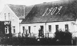
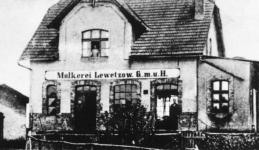
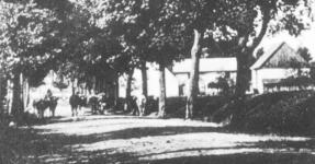
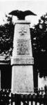
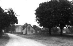
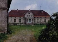
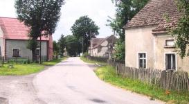
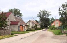
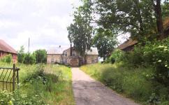
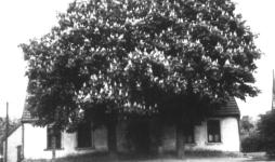
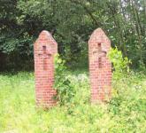
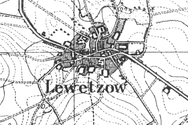
Lewetzow
(Now Lewice)
Kreis Greifenberg, Pommern
(Click on picture for larger image)
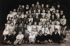
Related Families in Lewetzow
Navigation
Let me know if we are researching the same people or places.
Name and place indexes for this entire web site.
Information on just Kreis Greifenberg, Pommern.
Introduction to this web site.
This page created September 16th, 2002, updated September 18th, 2018, last edited December 15th, 2021
Kreis Greifenberg, Pommern
(Click on picture for larger image)
| |
| To zoom out to a larger area map click here. | |
|---|---|
Map dates from 1890, updated 1929. It covers an area of approximately 1.3 by 0.8 km (0.8 by 0.5 US miles).
Map image was adapted from 1:25K Prussian Landsaufnahme, page 1957
The following table shows which of the individuals included in this web site are connected to Lewetzow and over what time span they are found here.
| Surname | Given names and the range of dates the person was found in Lewetzow |
|---|---|
| Brandt |
 Maria 1867 Maria 1867 |
| Hoge |
 Albert August Hermann 1862 Albert August Hermann 1862 August Ferdinand 1828..1864Bertha Maria Therese 1857Dorothea Maria 1827Emilie Caroline Maria 1860Emilie Philippine Wilhelmine 1840Ferdinand 1833Franz Friedrich Wilhelm 1830Heinrich August 1856Johann 1832Johann Gottfried 1837Johanne Therese Wilhelmine 1835Johannes Hermann 1864Martin 1826..1840Otto Johann Friedrich 1855Wilhelmine 1826 August Ferdinand 1828..1864Bertha Maria Therese 1857Dorothea Maria 1827Emilie Caroline Maria 1860Emilie Philippine Wilhelmine 1840Ferdinand 1833Franz Friedrich Wilhelm 1830Heinrich August 1856Johann 1832Johann Gottfried 1837Johanne Therese Wilhelmine 1835Johannes Hermann 1864Martin 1826..1840Otto Johann Friedrich 1855Wilhelmine 1826 |
| Kressin / Krössin / Kroessin |
Martin 1855 |
| Lambrecht |
Caroline Wilhelmine Therese 1846David 1807..1847Friedericke Albertine 1834..1865 |
| Pape |
August Christian Erdmann 1844 |
| Polzin/Poltzin |
Catharine 1824..1842Dorothea 1830..1847 |
| Rüge |
Martin 1810 |
| Scheddin |
Maria 1832..1839 |
| Scheer/Schär |
Wilhelmine 1855..1865 |
| Tews |
 August Ferdinand 1830Caroline Wilhelmina Maria 1839Catherina 1759..1809Gottfried 1827..1869Hans 1732..1799Heinrich Wilhelm 1833Hermann Johann 1842Johann 1802..1872Johann Ferdinand 1832Johann Philipp 1836Johann Wilhelm 1835Johanne Marie 1824Martin 1805..1839Martin 1756..1830Martin 1732..1742 August Ferdinand 1830Caroline Wilhelmina Maria 1839Catherina 1759..1809Gottfried 1827..1869Hans 1732..1799Heinrich Wilhelm 1833Hermann Johann 1842Johann 1802..1872Johann Ferdinand 1832Johann Philipp 1836Johann Wilhelm 1835Johanne Marie 1824Martin 1805..1839Martin 1756..1830Martin 1732..1742 |
| Tietz |
Maria 1801..1851 |
| Volkmann |
Maria 1826..1861 |