Mitch Blank's North-German Genealogy Site

Let me know if we are researching the same people or places.


Name and place indexes for this entire web site.

Information on just Kreis Greifenberg, Pommern.

Introduction to this web site.
Copyright ©1998-2018 by Mitch Blank
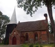
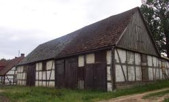
Klätkow
(Sometimes Klötkow, now Klodkowo)
Kreis Greifenberg, Pommern
(Click on picture for larger image)
Related Families in Klätkow
Navigation
Let me know if we are researching the same people or places.
Name and place indexes for this entire web site.
Information on just Kreis Greifenberg, Pommern.
Introduction to this web site.
This page created September 22nd, 2001, updated October 20th, 2014, last edited February 19th, 2018
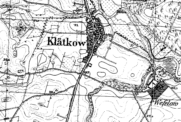
Kreis Greifenberg, Pommern
(Click on picture for larger image)
| |
| To zoom out to a larger area map click here. | |
|---|---|
Map dates from 1890, updated 1929. It covers an area of approximately 1.3 by 0.8 km (0.8 by 0.5 US miles).
Map image was adapted from 1:25K Prussian Landsaufnahme, page 1957
The following table shows which of the individuals included in this web site are connected to Klätkow and over what time span they are found here.
| Surname | Given names and the range of dates the person was found in Klätkow |
|---|---|
| Blank |
 Friedrich Wilhelm 1905 Friedrich Wilhelm 1905 Ida 1891 Ida 1891 |
| Erdmann |
Trin 1752 |
| Hintze |
 Albert Friedrich Wilhelm 1863 Albert Friedrich Wilhelm 1863 |
| Polzin/Poltzin |
Christian Erdmann 1752Peter 1742..1754 |
| Salchow |
Herman 1891 |