Mitch Blank's North-German Genealogy Site

Let me know if we are researching the same people or places.


Name and place indexes for this entire web site.

Information on just Kreis Greifenberg, Pommern.

Introduction to this web site.
Copyright ©1998-2019 by Mitch Blank
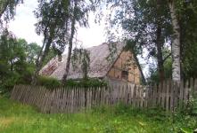
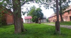
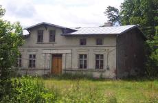
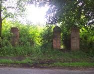
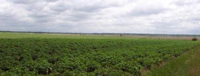
Arnsberg
(Now Gorzyslaw)
Kreis Greifenberg, Pommern
(Click on picture for larger image)
Related Families in Arnsberg
Navigation
Let me know if we are researching the same people or places.
Name and place indexes for this entire web site.
Information on just Kreis Greifenberg, Pommern.
Introduction to this web site.
This page created December 15th, 1999, last updated June 14th, 2019
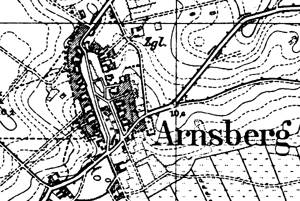
Kreis Greifenberg, Pommern
(Click on picture for larger image)
| |
| To zoom out to a larger area map click here. | |
|---|---|
Map dates from 1890, updated 1929. It covers an area of approximately 1.3 by 0.9 km (0.8 by 0.5 US miles).
Map image was adapted from 1:25K Prussian Landsaufnahme, page 1957
The following table shows which of the individuals included in this web site are connected to Arnsberg and over what time span they are found here.
| Surname | Given names and the range of dates the person was found in Arnsberg |
|---|---|
| Beise |
 Carl Friedrich Wilhelm 1883..1897 Carl Friedrich Wilhelm 1883..1897 Emil Otto Willy 1897Emilie Bertha Friedericke 1888..1906Emma Martha Maria 1894Lydia Auguste Marie 1883..1909Martha Emma Margaretha 1889Mathilde Helene Emilie 1886..1890Willy Emil Otto 1891 Emil Otto Willy 1897Emilie Bertha Friedericke 1888..1906Emma Martha Maria 1894Lydia Auguste Marie 1883..1909Martha Emma Margaretha 1889Mathilde Helene Emilie 1886..1890Willy Emil Otto 1891 |
| Blank |
Berthold Hermann Albert 1905..1909 |
| Froemming / Fröm(m)ing |
 Emil Hermann Reinhold 1904..1906 Emil Hermann Reinhold 1904..1906 |
| Kasten / Casten |
August Ferdinand 1842 Auguste Albertine 1851..1874Carl Hermann 1834Caroline Friederike 1836Caroline Wilhelmine 1839Johann Friedrich 1811..1856Marie Emilie 1831..1890Martin 1811..1845Wilhelmine Caroline 1854 Auguste Albertine 1851..1874Carl Hermann 1834Caroline Friederike 1836Caroline Wilhelmine 1839Johann Friedrich 1811..1856Marie Emilie 1831..1890Martin 1811..1845Wilhelmine Caroline 1854 |
| Laabs / Labes |
Catherina 1811..1817Maria 1850Martin 1788..1794 |
| Sohrweide |
Albert August Hermann 1875Bertha Friederike Maria 1864..1916Ferdinand August Wilhelm 1867Johann Carl Wilhelm 1862..1905Otto August Bernhard 1872..1904Pauline Mathilde Augusta 1870..1872 |
| Zimdars |
Marie 1831..1867 |