Mitch Blank's North-German Genealogy Site

Let me know if we are researching the same people or places.


Name and place indexes for this entire web site.

Information on just Kreis Greifenberg, Pommern.

Introduction to this web site.
Copyright ©1998-2017 by Mitch Blank
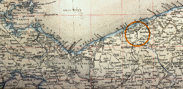
Central Pommerania
This map depicts the central portion of Pomerania, from a section of the 1883 Atlas des Deutschen Reichs by Ludwig Ravenstein.
Navigation
Let me know if we are researching the same people or places.
Name and place indexes for this entire web site.
Information on just Kreis Greifenberg, Pommern.
Introduction to this web site.
This page created February 13th, 2000, updated October 2nd, 2003
This map depicts the central portion of Pomerania, from a section of the 1883 Atlas des Deutschen Reichs by Ludwig Ravenstein.
| ||||
| To zoom out to a larger area map click here. | To zoom in to a more detailed map, click within any Gold Circle on the above map. | |||
|---|---|---|---|---|
Map dates from 1883.
Map image was adapted from Atlas des Deutschen Reichs