Mitch Blank's North-German Genealogy Site

Let me know if we are researching the same people or places.


Name and place indexes for this entire web site.

Information on just Western Mecklenburg.

Introduction to this web site.
Copyright ©1998-2017 by Mitch Blank
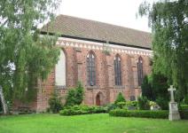
Hohen Viecheln
Kreis Schwerin, Mecklenburg-Schwerin
(Click on picture for larger image)
Related Families in Hohen Viecheln
Navigation
Let me know if we are researching the same people or places.
Name and place indexes for this entire web site.
Information on just Western Mecklenburg.
Introduction to this web site.
This page created May 4th, 2011, edited February 24th, 2017
Kreis Schwerin, Mecklenburg-Schwerin
(Click on picture for larger image)
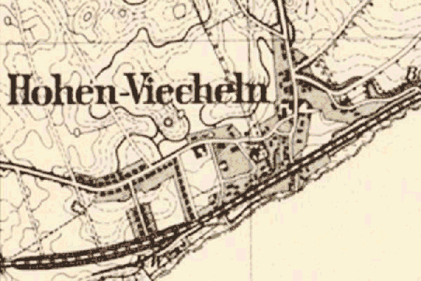
Map dates from 1881, updated 1904/1919. It covers an area of approximately 1.6 by 1.1 km (1.0 by 0.7 US miles).
Map image was adapted from 1:25K Prussian Landsaufnahme, page 2235
The following table shows which of the individuals included in this web site are connected to Hohen Viecheln and over what time span they are found here.
| Surname | Given names and the range of dates the person was found in Hohen Viecheln |
|---|---|
| Gosssel(c)k |
 Gabriel Cord Hinrich 1740..1819 Gabriel Cord Hinrich 1740..1819 |