Mitch Blank's North-German Genealogy Site

Let me know if we are researching the same people or places.


Name and place indexes for this entire web site.

Information on just Western Mecklenburg.

Introduction to this web site.
Copyright ©1998-2017 by Mitch Blank
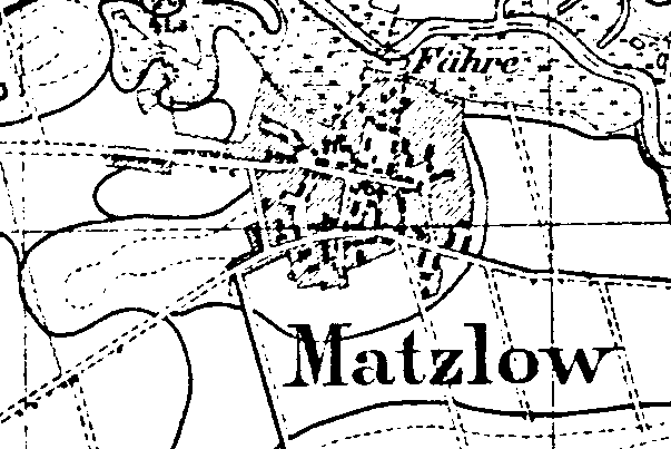
Matzlow
(Earlier sometimes Maßlow)
Kreis Parchim, Mecklenburg-Schwerin
Related Families in Matzlow
Navigation
Let me know if we are researching the same people or places.
Name and place indexes for this entire web site.
Information on just Western Mecklenburg.
Introduction to this web site.
This page created July 25th, 1999, last updated August 14th, 2017
Kreis Parchim, Mecklenburg-Schwerin
| |
| To zoom out to a larger area map click here. | |
|---|---|
Map dates from 1881, updated 1904/1924. It covers an area of approximately 1.3 by 0.9 km (0.8 by 0.5 US miles).
Map image was adapted from 1:25K Prussian Landsaufnahme, page 2536
The following table shows which of the individuals included in this web site are connected to Matzlow and over what time span they are found here.
| Surname | Given names and the range of dates the person was found in Matzlow |
|---|---|
| Becker |
 Chim 1678..1691Dorothea 1679..1704 Chim 1678..1691Dorothea 1679..1704 Hans 1680..1683Liese 1694 Hans 1680..1683Liese 1694 Maria 1680Trin 1683 Maria 1680Trin 1683 |
| Brandt / Brant |
 Ilse 1678 Ilse 1678 |
| Rhode / Rohde |
Anna Elisabeth 1690Claus 1682Claus 1679..1703Emma 1680..1683Hans 1679Jochim 1694Jochim 1680Johann 1688 |
| Wandschneider |
Rudolf 1893 |