Mitch Blank's North-German Genealogy Site

Let me know if we are researching the same people or places.


Name and place indexes for this entire web site.

Information on just Western Mecklenburg.

Introduction to this web site.
Copyright ©1998-2020 by Mitch Blank
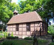
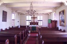
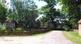
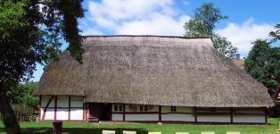
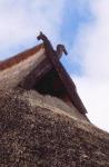
Damerow
(Now Alt Damerow)
Kreis Parchim, Mecklenburg-Schwerin
(Click on picture for larger image)
Related Families in Damerow
Navigation
Let me know if we are researching the same people or places.
Name and place indexes for this entire web site.
Information on just Western Mecklenburg.
Introduction to this web site.
This page created August 29th, 1999, updated October 11th, 2018, last edited April 13th, 2020
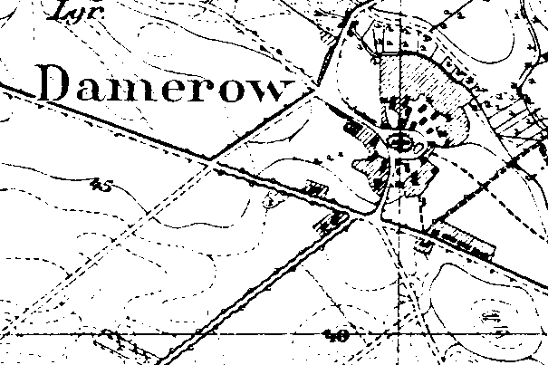
Kreis Parchim, Mecklenburg-Schwerin
(Click on picture for larger image)
| |
| To zoom out to a larger area map click here. | |
|---|---|
Map dates from 1881, updated 1904/1924. It covers an area of approximately 1.3 by 0.9 km (0.8 by 0.5 US miles).
Map image was adapted from 1:25K Prussian Landsaufnahme, page 2536
The following table shows which of the individuals included in this web site are connected to Damerow and over what time span they are found here.
| Surname | Given names and the range of dates the person was found in Damerow |
|---|---|
| Augustin |
 Anna Dorothea 1793..1829 Anna Dorothea 1793..1829 Daniel 1733..1734 Daniel 1733..1734 Jochim 1733Jochim 1781Maria Elisabeth 1734 Jochim 1733Jochim 1781Maria Elisabeth 1734 |
| Behrmann |
 Anna Maria 1808 Anna Maria 1808 |
| Borchert / Borchar(d/t) / Borcherdt |
Anna 1705 |
| Brandt / Brant |
Anna 1665..1715Ilse 1675..1678Maria Elisabeth 1788..1819 |
| Fölzer / Fölscher / Voltzer / Völzer / Woltzer |
Catharin 1608Maria 1759..1774 |
| Gävershagen |
Anna 1632..1693 |
| Harbrecht |
Anna 1687Cathrina Elisabeth 1746..1760Daniel 1657..1703Daniel 1698..1775Hans 1702..1734Jochim 1632..1692Jochim 1621..1632Jochim 1693..1697Johann 1696Maria 1690..1703 |
| Heyn / Hain / Heiden / Hayen |
Chim 1677Claus 1622..1702Maria 1656..1668Peter 1622..1636 |
| Hopp / Hoop |
Eleonora Dorothea 1761 |
| Klokow / Klockow / Glockow |
Stoffer 1682..1745 |
| Krull |
Hans Jochen 1781..1782Johann Jochen Wilhelm 1784..1786Johann Michel Erdmann 1786Lorentz Peter 1778..1793Sophia Margaretha Hanna 1778 |
| Lembke / Lem(b)cke |
Anna 1677 |
| Mar(k)quar(d)t / Markwardt |
Jochim 1701..1703Maria 1636..1659 |
| Marks / Marcs / Marcks / Marx |
Caroline Maria Friedrika 1881 |
| Niebehr/Niebuhr |
Hans 1656..1676 |
| Pingel |
Anna 1681..1751Anna Catharina 1702Anna Elisabeth 1713Anna Elisabeth 1718..1751Anna Elisabeth 1724Anna Maria 1741Anna Sophia 1682Catharina 1725..1751Catharina Elisabeth 1717..1754Cheel 1688..1703Cheel 1646..1676Cheel 1690Cheel 1608..1702Chim 1608Chistina 1720 Christian Wilhelm Erdmann 1793..1819Christina 1687..1703Christina 1702Christina Sophia 1744Christopher 1659..1681Claus 1655..1700Claus 1692..1721Daniel 1678..1760Daniel 1720Daniel 1686Daniel 1653..1703Daniel 1700Daniel 1793..1801Daniel 1680..1703Dorothea 1692Dorothea 1810..1819Elisabeth 1690Elisabeth Dorothea 1749..1799Elisabeth Sophia 1776..1801Elisabets 1684..1703Engel Dorothea 1728..1751Engel Dorothea 1752Ernst Friderich 1722Grete Dorthie 1744..1750Hans 1684..1757Hans 1679Hans 1638Hans 1696Hans Christian Wilhelm 1791..1792Hans Daniel 1741..1776Hans Daniel 1724..1751Hans Daniel 1793Hans Joachim 1714..1754Hans Jochim Daniel 1794..1853Hans Jochim Daniel 1773..1819Hans Jochim David 1798Jochim 1636..1716Jochim 1681Jochim 1696Jochim 1686..1746Jochim 1649..1710Jochim 1728Jochim Christian 1754..1768Jochim Christian 1722..1770Jochim Friderich 1720Johann Christian 1811..1819Johann Christian 1752Johann Christian 1713..1787Johann Christian Hinrick 1753..1761Johann Daniel 1752Johann Friederich Wilhem 1789..1791Johann Jochim Daniel 1798Johann Peter 1727Johanna Elisabeth 1764Johanna Sophia Catharina 1802..1819Margaret Dorothea 1694Margaretha Dorothea 1717Maria 1715Maria 1680Maria 1676Maria 1687Maria 1640Maria Elisabeth 1747Maria Elisabeth 1711Maria Elisabeth 1795Maria Elisabeth 1771Maria Elisabeth 1800Maria Elisabeth 1808..1819Maria Elisabeth Dorothea 1798Maria Elisabeth Dorothea 1805..1819Maria Margaratha Dorothea 1759Maria Sophia Wilhelmine 1807..1819Michel Wilhelm Erdmann 1767..1819Sophia 1700Sophia Dorothea 1796Sophia Magdalena 1756..1761Sophia Regina 1747..1796Stoffer 1643Thomas 1687Thomas 1696Thomas 1651..1716 Christian Wilhelm Erdmann 1793..1819Christina 1687..1703Christina 1702Christina Sophia 1744Christopher 1659..1681Claus 1655..1700Claus 1692..1721Daniel 1678..1760Daniel 1720Daniel 1686Daniel 1653..1703Daniel 1700Daniel 1793..1801Daniel 1680..1703Dorothea 1692Dorothea 1810..1819Elisabeth 1690Elisabeth Dorothea 1749..1799Elisabeth Sophia 1776..1801Elisabets 1684..1703Engel Dorothea 1728..1751Engel Dorothea 1752Ernst Friderich 1722Grete Dorthie 1744..1750Hans 1684..1757Hans 1679Hans 1638Hans 1696Hans Christian Wilhelm 1791..1792Hans Daniel 1741..1776Hans Daniel 1724..1751Hans Daniel 1793Hans Joachim 1714..1754Hans Jochim Daniel 1794..1853Hans Jochim Daniel 1773..1819Hans Jochim David 1798Jochim 1636..1716Jochim 1681Jochim 1696Jochim 1686..1746Jochim 1649..1710Jochim 1728Jochim Christian 1754..1768Jochim Christian 1722..1770Jochim Friderich 1720Johann Christian 1811..1819Johann Christian 1752Johann Christian 1713..1787Johann Christian Hinrick 1753..1761Johann Daniel 1752Johann Friederich Wilhem 1789..1791Johann Jochim Daniel 1798Johann Peter 1727Johanna Elisabeth 1764Johanna Sophia Catharina 1802..1819Margaret Dorothea 1694Margaretha Dorothea 1717Maria 1715Maria 1680Maria 1676Maria 1687Maria 1640Maria Elisabeth 1747Maria Elisabeth 1711Maria Elisabeth 1795Maria Elisabeth 1771Maria Elisabeth 1800Maria Elisabeth 1808..1819Maria Elisabeth Dorothea 1798Maria Elisabeth Dorothea 1805..1819Maria Margaratha Dorothea 1759Maria Sophia Wilhelmine 1807..1819Michel Wilhelm Erdmann 1767..1819Sophia 1700Sophia Dorothea 1796Sophia Magdalena 1756..1761Sophia Regina 1747..1796Stoffer 1643Thomas 1687Thomas 1696Thomas 1651..1716 |
| Prösch |
Sophia 1678..1726 |
| Rausch / Rusch |
Anne Sophie 1740..1757 |
| Rhode / Rohde |
Anna Elisabeth 1711..1759Elisabeth 1724..1751 |
| Rüze / Rütze |
Elisabeth 1687..1703Margaret 1682 |
| Steinhövel / Steinh(ae/ä)(f/v)el |
Catharina 1711..1745 |
| Swanck / Schwan(c)k |
Sophia 1709..1721 |
| Welzein / Welzin |
Anna 1711..1734Casten 1647..1707Chim 1647Christina 1719Elisabeth 1719Hans 1682..1721Hans 1715Hinrich 1715Jochim 1721Maria 1709Maria Dorothea 1826Sophia Dorothea 1713 |
| Witte |
Engel 1711..1753 |
| Zachow / Zachau |
Anna 1647Anna 1622 |