Mitch Blank's North-German Genealogy Site

Let me know if we are researching the same people or places.


Name and place indexes for this entire web site.

Information on just Western Mecklenburg.

Introduction to this web site.
Copyright ©1998-2018 by Mitch Blank
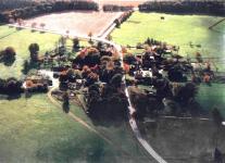
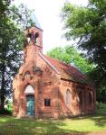
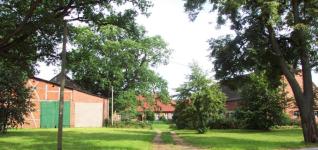
Bergrade
Kreis Parchim, Mecklenburg-Schwerin
(Click on picture for larger image)
Related Families in Bergrade
Navigation
Let me know if we are researching the same people or places.
Name and place indexes for this entire web site.
Information on just Western Mecklenburg.
Introduction to this web site.
This page created February 28th, 2000, last updated October 12th, 2018
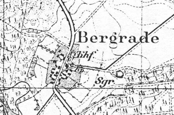
Kreis Parchim, Mecklenburg-Schwerin
(Click on picture for larger image)
| |
| To zoom out to a larger area map click here. | |
|---|---|
Map dates from 1881, updated 1904/1924. It covers an area of approximately 1.3 by 0.8 km (0.8 by 0.5 US miles).
Map image was adapted from 1:25K Prussian Landsaufnahme
The following table shows which of the individuals included in this web site are connected to Bergrade and over what time span they are found here.
| Surname | Given names and the range of dates the person was found in Bergrade |
|---|---|
| Baustian / Bostian |
 Ann Dorthie 1736..1750 Ann Dorthie 1736..1750 Anna Catharina 1706Christian Claus 1724 Anna Catharina 1706Christian Claus 1724 Claus 1677..1736Claus 1670..1677Hans Jacob 1716Hans Jochim 1731..1745Jacob 1675Jacob 1668..1677Jochim 1668Jochim Daniel 1729..1744Johann Christian 1721..1778Margareta Elisabeth 1727Maria 1709Maria Dorothea 1720Maria Margareta 1672Samuel Jochim 1713 Claus 1677..1736Claus 1670..1677Hans Jacob 1716Hans Jochim 1731..1745Jacob 1675Jacob 1668..1677Jochim 1668Jochim Daniel 1729..1744Johann Christian 1721..1778Margareta Elisabeth 1727Maria 1709Maria Dorothea 1720Maria Margareta 1672Samuel Jochim 1713 |
| Fölzer / Fölscher / Voltzer / Völzer / Woltzer |
Clawes 1535..1601Clawes 1505..1555Vytke 1503..1550 |
| Lembke / Lem(b)cke |
Anna 1650..1677Chim 1648..1650Dorothea 1648 |
| Martins |
 Maria 1720..1721 Maria 1720..1721 |
| Schade |
Elizabeth 1674..1703 |
| Schult |
Anna Catarina 1724..1759 |
| Witte |
Adam 1674Anna 1676Anna 1689Catharina 1684Dorothea 1689Elisabeth 1677Engel 1687..1711Hans 1680Hans 1648..1703Hans 1644..1650Jochim 1650Maria 1682Thomas 1644 |