Mitch Blank's North-German Genealogy Site

Let me know if we are researching the same people or places.


Name and place indexes for this entire web site.

Information on just this family and region.

Introduction to this web site.
Copyright ©1998-2017 by Mitch Blank
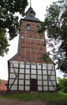
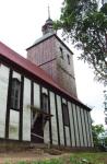
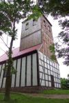
Taschenberg
Kreis Uckermark/Prenzlau, Brandenburg
(Click on picture for larger image)
Navigation
Let me know if we are researching the same people or places.
Name and place indexes for this entire web site.
Information on just this family and region.
Introduction to this web site.
This page created July 21st, 2001, updated September 3rd, 2005
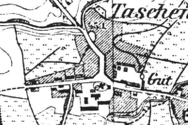
Kreis Uckermark/Prenzlau, Brandenburg
(Click on picture for larger image)
| |
| To zoom out to a larger area map click here. | |
|---|---|
Map dates from 1884, updated 1911/1932. It covers an area of approximately 0.9 by 0.6 km (0.5 by 0.4 US miles).
Map image was adapted from 1:25K Prussian Landsaufnahme, page 2648