Mitch Blank's North-German Genealogy Site

Let me know if we are researching the same people or places.


Name and place indexes for this entire web site.
Information on just this family and region.

Introduction to this web site.
Copyright ©1998-2017 by Mitch Blank
Neuhof
Kreis Uckermark/Prenzlau, Brandenburg
Related Families in Neuhof
Navigation
Let me know if we are researching the same people or places.
Name and place indexes for this entire web site.
Information on just this family and region.
Introduction to this web site.
This page created February 13th, 2002, updated July 3rd, 2013
Kreis Uckermark/Prenzlau, Brandenburg
| |
| To zoom out to a larger area map click here. | |
|---|---|
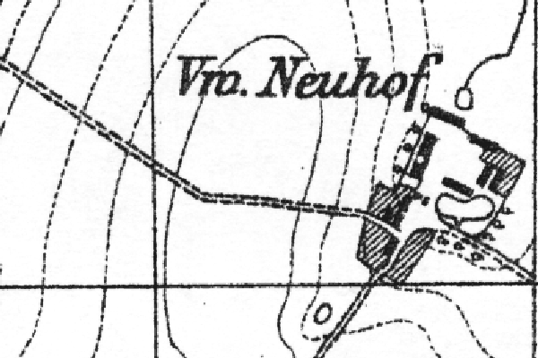
Map dates from 1884, updated 1932. It covers an area of approximately 0.9 by 0.6 km (0.5 by 0.4 US miles).
Map image was adapted from 1:25K Prussian Landsaufnahme, page 2438 (old 1052)
The following table shows which of the individuals included in this web site are connected to Neuhof and over what time span they are found here.
| Surname | Given names and the range of dates the person was found in Neuhof |
|---|---|
| Mührke / M(i)erke / M(ö/u/ü)r(c)k(e) / Merke |
 Carl Christian Friedrich 1849..1853 Carl Christian Friedrich 1849..1853 |