Mitch Blank's North-German Genealogy Site

Let me know if we are researching the same people or places.


Name and place indexes for this entire web site.

Information on just this family and region.

Introduction to this web site.
Copyright ©1998-2018 by Mitch Blank
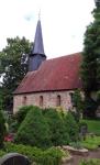
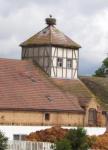
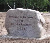
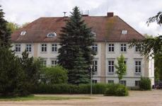
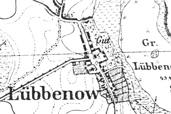
Lübbenow
Kreis Uckermark/Prenzlau, Brandenburg
(Click on picture for larger image)
Related Families in Lübbenow
Navigation
Let me know if we are researching the same people or places.
Name and place indexes for this entire web site.
Information on just this family and region.
Introduction to this web site.
This page created July 21st, 2001, last updated December 8th, 2018
Kreis Uckermark/Prenzlau, Brandenburg
(Click on picture for larger image)
| |
| To zoom out to a larger area map click here. | |
|---|---|
Map dates from 1884, updated 1911/1932. It covers an area of approximately 1.3 by 0.8 km (0.8 by 0.5 US miles).
Map image was adapted from 1:25K Prussian Landsaufnahme, page 2648
The following table shows which of the individuals included in this web site are connected to Lübbenow and over what time span they are found here.
| Surname | Given names and the range of dates the person was found in Lübbenow |
|---|---|
| Krüger |
 Hanna Maria Sophie 1851 Hanna Maria Sophie 1851 |
| Neuman(n) / Newman(n) |
Ephraim Adolpf Friedrich 1849Johann Friedrich 1857 Sophie Christine Friederike 1849..1865 Sophie Christine Friederike 1849..1865 |
| Ruthenberg |
 August Friedrich Wilhelm 1855Auguste Wilhelmine Ernestine 1865Friedrich Wilhelm 1849Hermann August Friedrich Wilhelm 1862..1865 August Friedrich Wilhelm 1855Auguste Wilhelmine Ernestine 1865Friedrich Wilhelm 1849Hermann August Friedrich Wilhelm 1862..1865 Johann Friedrich 1848..1878Johanne Ernestine Caroline 1858 Johann Friedrich 1848..1878Johanne Ernestine Caroline 1858 |
| Schmidt |
Maria Dorothee 1848 |